Saul Surveying and Mapping Logo
 Services
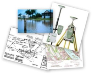
We provide a wide range of Surveying including:
  • Boundary Surveys
  • A boundary survey determines the property lines of a parcel of land described in a deed. It will also indicate the extent of any easements or encroachments and may show the limitations imposed on the property by state or local regulations.
  • Oil & Gas Surveys
  • Mortgage Surveys
  • Topographic Surveys
  • ALTA/ACSM – As-builts
  • Subdivision Plats
  • Construction Layout
  • Flood Elevation Certificates
  • GPS control points
  • Title Surveys


Another Day in Paradise Staking an Oil Well.
              
Josh with the Total Station deep in the big woods.

Senior party chief Dale setting the control point with RTK GPS.

454 Short 7th Ave.    •    Laurel, Mississippi 39440    •    (601) 428-0600


Mississippi Land Surveyor | Mississippi Construction Staking | Mississippi Flood Elevation Certificate | Alabama Land Surveyor | Alabama Construction Staking | Alabama Flood Elevation Certificate | Resources